Can satellite AI travel across regions?
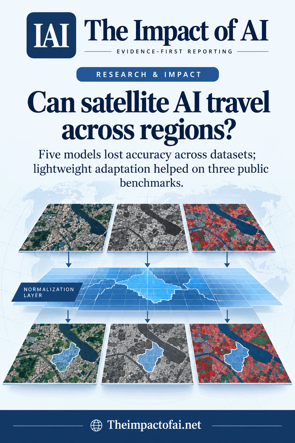
A peer-reviewed Egyptian benchmark found that five change-detection models lost accuracy when moved between Chinese and French remote-sensing datasets. Aligning feature statistics and adding ten labelled target examples recovered part of the gap, but the study covers three public benchmarks—not live disaster or climate operations.
Editorial responsibility: The Impact of AI Editorial Desk · Report a factual concern
Research topic
How well modern remote-sensing change-detection models generalise across regions, sensors and annotation conventions, and whether feature alignment plus ten labelled target samples reduces the domain gap
At a glance
- 1Five architectures were trained and tested across CLCD, HRSCD and auxiliary LEVIR-CD under in-domain, direct cross-domain and ten-shot adaptation settings.
- 2Moving between datasets reduced intersection-over-union scores. In one HRSCD-to-CLCD example, STNet fell to 78.45% IoU; feature normalisation raised it to 83.10%.
- 3Ten labelled target examples improved adapted performance over five random draws, but the study did not test prospective monitoring, unseen sensors, disaster decisions or community outcomes.
The Impact Brief
Keep the evidence trail, not the noise.
Get the most consequential AI developments with direct sources and clear limits.
Living evidence record
Impact record IAI-1CMP22A
Evidence stage
Studied
Confidence
Supported
Reporting basis
Source analysis
Independent support
Present
Record status
Monitoring
Last checked
3 October 2026
Source trail
3 direct sources across 1 source type.
People impact
Documented in this record.
Uncertainty
Limits and next checks are explicit.
Stages describe the evidence available—not whether a technology is good or bad. See the public method.
Related-source reporting disclosure
This record analyses 3 linked source records around the same underlying development. The extra records add method, date or context, but they do not by themselves constitute independent replication of every performance claim or predicted outcome.
The deployment question
Remote-sensing change detection compares images from different dates to locate altered land, buildings or vegetation. It supports urban planning, environmental monitoring and disaster assessment, but a model trained on one country or sensor can learn local colour, resolution, season and labelling conventions instead of a durable concept of change. The Egyptian team built CrossCD-Eval to make that transfer failure visible and to test a lightweight way to align internal feature statistics between source and target domains.
Five architectures—GLAFormer, Change-Mamba, EHCTNet, ELGC-Net and STNet—were compared under three conditions. In-domain training and testing established an optimistic baseline. Cross-domain tests moved a model directly to another dataset. Ten-shot adaptation then supplied only ten labelled examples from the target training split. The target test set remained fixed and unseen, and the same ten examples were used for matched runs with and without the proposed normalisation layer.[1][2][3]
Three public datasets, not one universal Earth sample
The primary pair was CLCD and HRSCD. CLCD contains 512-by-512 bitemporal patches from urban and rural areas around Changsha, China, with pixel-level change labels. HRSCD uses French high-resolution imagery and contains more than 30,000 patch pairs at 256 by 256 pixels; the study reduced its official labels to binary change versus no change. LEVIR-CD contributed 637 pairs of 1024-by-1024 urban images with building-change annotations as an auxiliary domain.
Before training, the pipeline checked paired-image and mask integrity, aligned ground-sampling distance, resized patches and matched intensity histograms. That preprocessing already reduces part of the domain gap and is therefore an important comparator. Domain-Aware Feature Normalisation, or DAFN, was then added between encoder and decoder so target features were shifted and scaled toward source statistics. The central question was whether that intervention adds value beyond making the pixels look more comparable.[1][2][3]
Training and evaluation design
All five systems used a shared protocol where possible: AdamW optimisation, an initial learning rate and weight decay of 0.0001, batch size 16, up to 100 epochs and early stopping after ten epochs without validation-IoU improvement. The loss combined binary cross-entropy and Dice terms. Performance was reported with intersection over union, F1, precision, recall and overall accuracy. For few-shot adaptation, the ten target samples were drawn five times with seeds one to five, and mean and standard deviation were reported.
The study also compared DAFN with source-only processing, full geometric and histogram preprocessing, adaptive batch-normalisation, adversarial feature alignment and the standalone instance-normalisation-based CrossCDNet. Change-Mamba and STNet represented different backbone families in that ablation. This is stronger than comparing only against an unprocessed baseline because it asks whether the new layer contributes beyond ordinary harmonisation and established adaptation approaches.[1]
Where accuracy fell—and recovered
In-domain scores were high: on CLCD, Change-Mamba reached 90.50% IoU and STNet 89.20%; on HRSCD, they reached 93.91% and 93.12%. Cross-domain transfer was lower. When trained on HRSCD and tested on CLCD, Change-Mamba scored 76.13% and STNet 78.45%. DAFN raised those figures to 80.58% and 83.10%. In the opposite CLCD-to-HRSCD direction, gains were smaller: Change-Mamba moved from 90.78% to 91.25%, and STNet from 91.22% to 91.88%.
Ten-shot adaptation narrowed the gap further. With CLCD as source and ten HRSCD samples, Change-Mamba plus DAFN reached 92.60% mean IoU with a 0.68-point standard deviation, approaching its 93.91% HRSCD in-domain score. Across repeated HRSCD target draws, DAFN reduced IoU variability by roughly 19% to 22%. Ten curated examples may therefore stabilise benchmark transfer, but they do not represent the clouds, sensor drift, rare events and annotation disputes faced in continuous operations.[1]
What the comparison cannot establish
CrossCD-Eval measures binary pixel overlap on three established datasets. It does not show whether the detected change is a flood, demolition, crop transition or annotation difference; it does not test analysts making decisions under time pressure; and it does not measure false alarms across a live stream. Synthetic blur and cloud-degraded images are mentioned as additional data available from the authors, but the main conclusions still depend on known benchmark splits and labels.
The domains are narrower than the phrase cross-domain can imply. Two primary datasets represent China and France, while LEVIR-CD is an urban building-change auxiliary set. Optical-to-radar transfer, open-set land classes, missing labels and sensor combinations are future work. Model-specific tuning was intentionally limited for fairness, which helps comparison but may understate a carefully tuned deployment. Conversely, one research pipeline selecting architectures, preprocessing and target samples can look cleaner than an independent operational replication.[1]
People, disclosures and the next threshold
For environmental agencies, humanitarian teams and planners, the useful message is operational: a high in-domain score should not be accepted as proof that a model can move to another region. Teams need a local holdout set, sensor and season audits, uncertainty maps, preserved imagery provenance and human review of consequential alerts. Ten carefully chosen labels may offer a low-cost calibration step, but affected communities need errors measured as missed homes, false damage flags and unequal monitoring—not only aggregate IoU.
The authors are based at Ain Shams University and Egypt's National Authority for Remote Sensing and Space Sciences. They report no funding and no competing interests. Public benchmarks support partial replication, but additional generated robustness data are available only on request and no public code repository is identified. Confidence would rise with released code, pre-registered external tests on unseen countries and sensors, optical–SAR evaluation, calibrated uncertainty and evidence that adaptation improves real decisions without shifting errors onto underrepresented places.[1][2][3]
What this means for people
- Remote-sensing teams may need fewer locally labelled examples to adapt a model, but still require experts to verify consequential changes.
- Communities could benefit from faster monitoring only if errors are measured across places that differ from training data.
- Public agencies should not automate land-use or damage decisions from a benchmark score without audit and appeal routes.
Global context
The research is led from Egypt and tests Chinese, French and auxiliary North American-style urban benchmarks, giving it cross-regional ingredients. Its broader value is showing that geographic and sensor transfer must be measured explicitly; its own evidence still covers a small fraction of the world's landscapes and uses.
What the evidence does not yet show
- The evaluation uses three optical-image benchmarks, with two primary geographic domains, and does not establish transfer to unseen sensors, countries, seasons or disasters.
- Results are pixel metrics rather than operational outcomes; the study does not measure analyst decisions, alert burden or community impact.
- Ten-shot adaptation used curated labelled target samples; operational selection and annotation quality may be harder.
- No public code repository is identified, while additional synthetic degradation data are available only on request.
What to watch next
- Open code and independently reproduced source–target results with identical splits and preprocessing.
- Prospective tests on unseen regions, optical–SAR pairs, clouds, sensor drift and rare disasters with calibrated uncertainty.
- Decision-level evaluation showing whether adaptation reduces harmful misses and false alarms.
Evidence trail
Sources used for this report
Links checked 3 October 2026
This report is labelled source analysis. We summarise and analyse source material in our own words; company statements remain attributed claims until independently supported. Translated summaries preserve the meaning of the original source and link back to it. Read our editorial standards.
Continue the story
Related reporting
Climate & Energy
Can satellite AI show where a town stays cooler?
A peer-reviewed Algeria case study compared four machine-learning methods on seven Landsat 9 scenes. The maps may help frame local heat questions, but the apparent accuracy comes from only 30 held-out proxy points—not field temperatures, human exposure or health outcomes.
9 min · 2 sources
Climate & Energy
Can AI track Antarctica's smallest ecosystems without replacing fieldwork?
A seven-year Canada Glacier study links field observations, drone imagery and Sentinel-2 data. The peer-reviewed framework is promising, but it has been tested at one Antarctic site and its dataset is not yet public.
5 min · 3 sources
Climate & Energy
Can AI warn of severe storms before radar sees them?
A peer-reviewed East China study combined radar, weather stations and three-dimensional atmospheric forecasts to predict severe convection up to 12 hours ahead. The model improved many rain and reflectivity scores, but extreme gusts, regional transfer and operational warning benefits remain unproven.
11 min · 3 sources
Reader discussion
Add evidence, experience or a question
No account is required. Reader notes are published after a brief civility, relevance and safety check; disagreement is welcome.
Published reader notes
0No published reader notes yet. You can start the evidence-led discussion above.
Prefer a private correction or response? Contact the newsroom.