Can AI make local rainfall projections more useful?
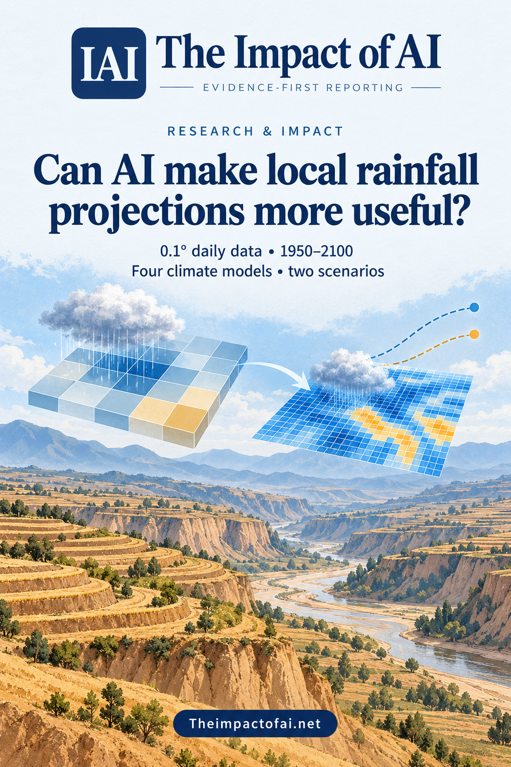
A new peer-reviewed dataset uses deep learning to translate four global climate models into daily 0.1° precipitation fields for China’s Loess Plateau from 1950 to 2100. It adds spatial detail for research and planning, but cannot remove climate-model uncertainty or verify rainfall decades ahead.
Editorial responsibility: The Impact of AI Editorial Desk · Report a factual concern
At a glance
- 1The dataset provides daily precipitation at 0.1° resolution across the Loess Plateau from 1950 to 2100, using four CMIP6 global climate models and the SSP2-4.5 and SSP5-8.5 scenarios.
- 2An attention-based Laplacian pyramid network adds fine spatial structure and better represents historical local precipitation distributions and extremes than the coarse source fields, according to the paper's validation.
- 3Downscaling does not create a certain local forecast. Future results inherit global-model, emissions-scenario and non-stationarity uncertainty and should be used as an ensemble with observations and domain judgement.
Research topic
Deep-learning downscaling of four CMIP6 global climate models into daily 0.1-degree precipitation fields over the Loess Plateau
The direct answer: finer planning evidence, not a street-level forecast
Deep learning can turn coarse global-climate output into a much finer regional precipitation dataset, making patterns easier to analyse for water, agriculture, erosion and hazard research. Jianing Guo and colleagues released daily precipitation fields at 0.1° spatial resolution for China's Loess Plateau from 1950 through 2100. The record combines historical simulations with two future pathways—SSP2-4.5 and SSP5-8.5—from four models in the Coupled Model Intercomparison Project Phase 6, or CMIP6.
The result is not a verified prediction of how much rain will fall in a particular place on a particular future day. Statistical downscaling learns relationships between large-scale atmospheric conditions and fine-scale historical precipitation. It can restore plausible spatial texture and correct recurring biases, but it cannot observe the future or repair every weakness in a global model. The dataset is most useful as a structured ensemble for research and stress-testing, with uncertainty retained rather than hidden behind the finer grid.[1]
What the AI system adds to coarse climate output
The researchers used an attention-based Laplacian pyramid network. Pyramid architectures estimate information at progressively finer scales, while attention mechanisms help the model emphasise spatial features that matter for precipitation. The network takes large-scale atmospheric variables associated with the CMIP6 simulations and generates regional daily rainfall fields on the 0.1° grid. Static geographic information can help it represent how complex terrain shapes local patterns.
This addresses a practical mismatch. Global models are designed to simulate the climate system, not the rainfall contrast between every valley, slope and urban catchment. The Loess Plateau is semi-arid and highly sensitive to drought, intense rainfall, soil erosion and geological hazards. A finer grid can support calculations that are impossible or misleading with a coarse source cell, such as comparing local extreme-rainfall distributions or driving regional hydrological and ecosystem models.[1]
The dataset spans four models and two scenarios
Using four CMIP6 models is stronger than presenting one model trajectory as the answer. Each global model represents atmospheric and land processes differently, so their spread offers one view of structural uncertainty. SSP2-4.5 is an intermediate emissions and development pathway, while SSP5-8.5 represents a much higher forcing pathway. These are scenarios for analysis, not probabilities assigned by the paper and not predictions that society will necessarily follow either route.
The long 1950–2100 time span allows researchers to compare a historical baseline with future periods using a consistent data format. Daily resolution matters because annual or monthly averages can conceal short heavy-rainfall events that drive flash flooding and erosion. Yet the apparent completeness of a daily series should not be mistaken for day-specific predictability. Climate projections are intended to characterise distributions, trends and plausible extremes across periods, not to tell a farmer the weather on a date decades from now.[1]
What the validation shows—and what it cannot show
The paper reports that the deep-learning outputs better represent spatial detail and extreme precipitation features than the original global-model fields and capture local probability distributions of daily precipitation across the region. Historical comparison is essential: a downscaling method should reproduce observed spatial and statistical behaviour before anyone uses its future products. The dataset is published as a Scientific Data descriptor, where technical validation and reuse are central purposes rather than a single headline forecast.
Historical skill is necessary but not sufficient for future reliability. The model learns from a climate range that has already occurred, then operates under future atmospheric conditions that may move beyond that range. A relationship between circulation and local rainfall can also change as warming alters moisture, convection and land–atmosphere feedbacks. Fine detail may look physically persuasive while remaining conditional on the learned mapping. Users need comparisons with observations, other statistical methods and regional dynamical models, especially for rare extremes.[1]
How planners and researchers can use it responsibly
A water manager could use the four-model ensemble to test whether a reservoir, soil-conservation programme or early-warning threshold remains robust across plausible rainfall futures. Agricultural researchers could drive crop or erosion models with the daily series and report the range of outcomes rather than one central line. Disaster-risk teams could identify locations where several model–scenario combinations point toward increasing extremes, then combine that evidence with gauges, terrain, exposure and engineering studies.
The dataset should not be used as the sole basis for a costly local decision. The 0.1° grid is still an area average, not a property-level measurement, and extreme rainfall can vary sharply within a cell. Bias correction and downscaling may also affect long-term trends or spatial dependence. Good practice is to retain the model and scenario identifiers, compare against local observations, evaluate the variables relevant to the decision and test whether conclusions hold when one model or method is removed.[1]
What would increase confidence
Independent teams should reproduce the processing and evaluate the data against withheld rain gauges and satellite products, reporting ordinary rainfall, dry-day frequency and multiple extreme indices. Comparisons with dynamical downscaling would show where the neural network agrees with a physics-based regional model and where it diverges. Stress tests under record-breaking events and atmospheric states outside the training distribution would be especially valuable for adaptation decisions.
The work was supported by the Chinese Academy of Sciences Strategic Priority Research Program, China's National Key R&D Program, the National Natural Science Foundation of China and the Chinese Academy of Sciences Youth Innovation Promotion Association. The authors declare no competing interests. The practical advance is a reusable, high-resolution research resource for an exposed region. The unresolved question is how much of its fine-scale historical skill survives in a warmer, non-stationary climate—precisely the uncertainty users must carry into decisions.[1]
What this means for people
- Finer regional evidence could help communities and agencies test water, farming, erosion and flood plans against several climate futures.
- False precision could misdirect investment if a single grid cell or model run is treated as a certain local forecast.
- Local observations and affected communities remain necessary to translate a regional dataset into practical adaptation decisions.
Global context
The Loess Plateau is a major Chinese agricultural and ecological region with severe erosion and water constraints. The dataset is geographically specific, but the method reflects a global push to make coarse climate simulations more locally actionable. Transfer to other regions requires new training and validation: terrain, monsoon dynamics, observation density and rainfall extremes differ, and a model that works in northern China cannot be assumed to work elsewhere.
What the evidence does not yet show
- Downscaled output inherits uncertainty and bias from the four CMIP6 source models and the selected emissions scenarios.
- Historical validation cannot verify daily precipitation in future decades or guarantee that learned relationships remain stable under warming.
- A 0.1° grid adds regional detail but is not a site-specific rain-gauge measurement or property-level forecast.
- Only two future scenarios and four global models are included, so the ensemble does not span every plausible climate pathway or model structure.
- Fine-looking spatial structure can create false precision unless users retain model, scenario and methodological uncertainty.
What to watch next
- Independent validation against withheld gauges, satellite products and extreme-rainfall indices.
- Comparisons with regional dynamical downscaling and other statistical methods.
- Hydrology, erosion and agricultural studies that propagate the full four-model and two-scenario range.
- Tests of performance under record events and future atmospheric conditions outside the historical training range.
Living evidence record
Impact record IAI-1HTOE18
Evidence stage
Studied
Confidence
Supported
Reporting basis
Source analysis
Independent or research support
Present
Record status
Monitoring
Last checked
8 October 2026
Source trail
1 direct source across 1 source type.
People impact
Documented in this record.
Uncertainty
Limits and next checks are explicit.
Stages describe the evidence available—not whether a technology is good or bad. See the public method.
Single-source reporting disclosure
This record analyses one direct source. It can establish what Scientific Data published or reported, but it is not independent corroboration of every performance claim or predicted outcome. The confidence label will change only when broader evidence is added.
Evidence trail
Sources used for this report
Links checked 8 October 2026
This report is labelled source analysis. We summarise and analyse source material in our own words; company statements remain attributed claims until independently supported. Translated summaries preserve the meaning of the original source and link back to it. Read our editorial standards.
Continue the story
Related reporting
Climate & Energy
Can AI warn of severe storms before radar sees them?
A peer-reviewed East China study combined radar, weather stations and three-dimensional atmospheric forecasts to predict severe convection up to 12 hours ahead. The model improved many rain and reflectivity scores, but extreme gusts, regional transfer and operational warning benefits remain unproven.
11 min · 3 sources
Climate & Energy
Can AI agents find water leaks?
A peer-reviewed system coordinated hydraulic simulation, network partitioning, sensor placement and graph-based detection across five water networks. Its strongest result came from simulated leaks equal to 20% of total demand—not a live utility trial or proof that a language model found a physical leak.
8 min · 3 sources
Climate & Energy
Can AI forecast Egypt’s groundwater decline?
A peer-reviewed study combines 21 years of satellite water-storage estimates with land-use mapping and XGBoost for Wadi El-Assiuti. The held-out fit is strong, but the study area is smaller than one GRACE cell and the 2030 path assumes recent conditions continue.
9 min · 1 source
The Impact Brief
Keep the evidence trail, not the noise.
Get the most consequential AI developments with direct sources and clear limits.
Reader commentary
Add evidence, experience or a question
No account is required. Reader notes are published after a brief civility, relevance and safety check; disagreement is welcome.
Explore commentary across the portal →Published reader notes
0No published reader notes yet. You can start the evidence-led discussion above.
Prefer a private correction or response? Contact the newsroom.